
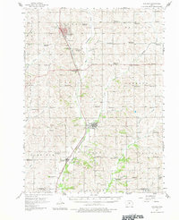
1957 Map of Audubon
USGS Topo · Published 1958About this map
The Audubon landscape in the mid-1950s was a study in classic Midwestern agricultural and rail-oriented settlement patterns. The Chicago and North Western and Chicago Rock Island and Pacific railroads provided the primary arteries for commerce, linking the communities of Exira, Brayton, and Hamlin through the river valleys. A network of rural schools, many already noted as abandoned by 1957—such as School No 5 and School No 7—reveals the ongoing consolidation of the district system that once placed a one-room schoolhouse in every township section.
Find a feature on this map
64 named features on this map. Tap any name to fly to it.
Don’t see what you’re looking for? This feature index may not catch every label — zoom into the map to look around manually.
Map Details
Editions of this 1957 Audubon Map
2 editions found
Other maps of this area

1954 · Omaha
USGS Topo · 1:250,000

1957 · Omaha
USGS Topo · 1:250,000

1958 · Omaha
USGS Topo · 1:250,000

1971 · Coon Rapids South
USGS Topo · 1:24,000

1971 · Viola Center
USGS Topo · 1:24,000

1971 · Adair South
USGS Topo · 1:24,000

1971 · Anita
USGS Topo · 1:24,000

1971 · Wiota
USGS Topo · 1:24,000

1971 · Atlantic
USGS Topo · 1:24,000

1971 · North Branch
USGS Topo · 1:24,000