
1971 Map of Anita
USGS Topo · Published 1973About this map
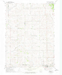
Anita serves as the central hub of this Cass County landscape, situated where the Chicago and Pacific Rock Island railroad tracks bisect the town's grid. The era's recreational development is centered on the expansive Lake Anita State Park and its accompanying campground, which surround the waters of Lake Anita. This man-made reservoir provides a distinct contrast to the natural meandering paths of Troublesome Creek, Turkey Creek, and Crooked Creek that drain the surrounding agricultural townships of Benton, Grant, Franklin, and Lincoln. Local history and genealogy interest is found in the three rural burial grounds spaced across the quadrangle: Highland Cem, Evergreen Cem, and St Josephs Cem. Further civic infrastructure is evidenced by the Anita Municipal Airport and the Crestwood Golf Club, reflecting the mid-century growth of the area's local amenities.
Find a feature on this map
21 named features on this map. Tap any name to fly to it.
Don’t see what you’re looking for? This feature index may not catch every label — zoom into the map to look around manually.
Map Details
Editions of this 1971 Anita Map
This is the sole edition of this map. No revisions or reprints were ever made.
Other maps of this area

1954 · Omaha
USGS Topo · 1:250,000

1957 · Omaha
USGS Topo · 1:250,000

1957 · Audubon
USGS Topo · 1:62,500

1958 · Omaha
USGS Topo · 1:250,000

1971 · Adair South
USGS Topo · 1:24,000

1971 · Wiota
USGS Topo · 1:24,000

1971 · Anita SW
USGS Topo · 1:24,000

1971 · Massena
USGS Topo · 1:24,000

1971 · Fontanelle SW
USGS Topo · 1:24,000
1971 · Adair North
USGS Topo · 1:24,000