
1971 Map of North Branch
USGS Topo · Published 1973About this map
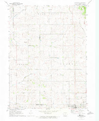
North Branch sits at the intersection of rural life and natural drainage in Guthrie County during the early 1970s. The landscape is defined by the headwaters and winding paths of several waterways, including Frost Creek, Lone Grove Creek, and the aptly named Troublesome Creek. The map documents the enduring spiritual and communal anchors of the region, featuring Bowman Chapel and cemeteries such as Township Cem and Pleasant Hill Cem. Straddling the border between Audubon and Guthrie counties, the area is organized into distinct townships including Union, Bear Grove, and Greeley. A modern industrial layer is introduced by a pipeline that cuts diagonally across the township grids, illustrating the 20th-century utility infrastructure superimposed upon an established agricultural layout. This survey captures the rural character of the Iowa countryside before significant shifts in late-century farming and land use occurred.
Find a feature on this map
16 named features on this map. Tap any name to fly to it.
Don’t see what you’re looking for? This feature index may not catch every label — zoom into the map to look around manually.
Map Details
Editions of this 1971 North Branch Map
This is the sole edition of this map. No revisions or reprints were ever made.
Other maps of this area

1954 · Omaha
USGS Topo · 1:250,000

1957 · Omaha
USGS Topo · 1:250,000

1957 · Audubon
USGS Topo · 1:62,500

1958 · Omaha
USGS Topo · 1:250,000

1971 · Coon Rapids South
USGS Topo · 1:24,000

1971 · Viola Center
USGS Topo · 1:24,000

1971 · Bayard
USGS Topo · 1:24,000

1971 · Casey
USGS Topo · 1:24,000

1971 · Guthrie Center West
USGS Topo · 1:24,000
1971 · Adair North
USGS Topo · 1:24,000