
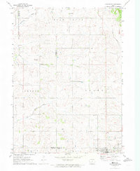
1971 Map of Guthrie Center West
USGS Topo · Published 1973About this map
Guthrie Center occupies the eastern edge of this western Iowa landscape, where the town's residential grid meets the Fairground and the Guthrie Center Municipal Airport. The terrain is defined by the winding course of the South Raccoon River, which draws a green belt through the center of the map, and several smaller tributaries like Seely Creek and Frost Creek. This 1970s survey illustrates a region of dispersed rural settlements and local civic infrastructure, including the Townhall north of the river and the Wichita community to the northwest.
Find a feature on this map
19 named features on this map. Tap any name to fly to it.
Don’t see what you’re looking for? This feature index may not catch every label — zoom into the map to look around manually.
Map Details
Editions of this 1971 Guthrie Center West Map
This is the sole edition of this map. No revisions or reprints were ever made.
Other maps of this area

1952 · Panora
USGS Topo · 1:62,500

1954 · Bagley
USGS Topo · 1:62,500

1954 · Omaha
USGS Topo · 1:250,000

1957 · Omaha
USGS Topo · 1:250,000

1958 · Omaha
USGS Topo · 1:250,000

1971 · Coon Rapids South
USGS Topo · 1:24,000

1971 · Bayard
USGS Topo · 1:24,000

1971 · North Branch
USGS Topo · 1:24,000

1971 · Casey
USGS Topo · 1:24,000
1971 · Adair North
USGS Topo · 1:24,000