1971 Map of Atlantic
USGS Topo · Published 1973About this map
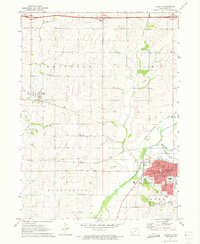
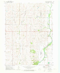
Atlantic serves as the regional hub at the confluence of the Nishnabotna River and Troublesome Creek. The town's grid is dense with civic infrastructure, including the Courthouse, City Hall, and the Armory. An industrial and transportation corridor follows the Chicago Rock Island and Pacific railroad, which arcs through the valley toward the smaller settlement of Marne in the west. Outside the city limits, the landscape transitions to the agricultural townships of Brighton and Pymosa. The distribution of rural landmarks like Buck Creek Ch and several district schools, such as Jackson Sch and Pymosa Sch, reflects a well-established farming community. Traces of older transit routes are still visible, notably the Old R R Grade near Marne, which contrasts with the modern Pipeline infrastructure and the Atlantic Municipal Airport that supported the area's mid-century growth.
Find a feature on this map
38 named features on this map. Tap any name to fly to it.
Don’t see what you’re looking for? This feature index may not catch every label — zoom into the map to look around manually.
Map Details
Editions of this 1971 Atlantic Map
This is the sole edition of this map. No revisions or reprints were ever made.
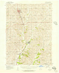
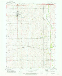
Other maps of this area

1954 · Omaha
USGS Topo · 1:250,000

1957 · Omaha
USGS Topo · 1:250,000
1957 · Audubon
USGS Topo · 1:62,500

1958 · Omaha
USGS Topo · 1:250,000
1971 · Walnut
USGS Topo · 1:24,000
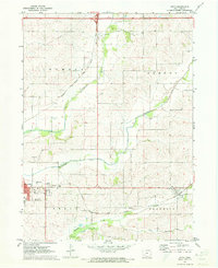
1971 · Wiota
USGS Topo · 1:24,000
1971 · Atlantic SW
USGS Topo · 1:24,000
1971 · Anita SW
USGS Topo · 1:24,000
1971 · Lewis
USGS Topo · 1:24,000
1978 · Elk Horn
USGS Topo · 1:24,000