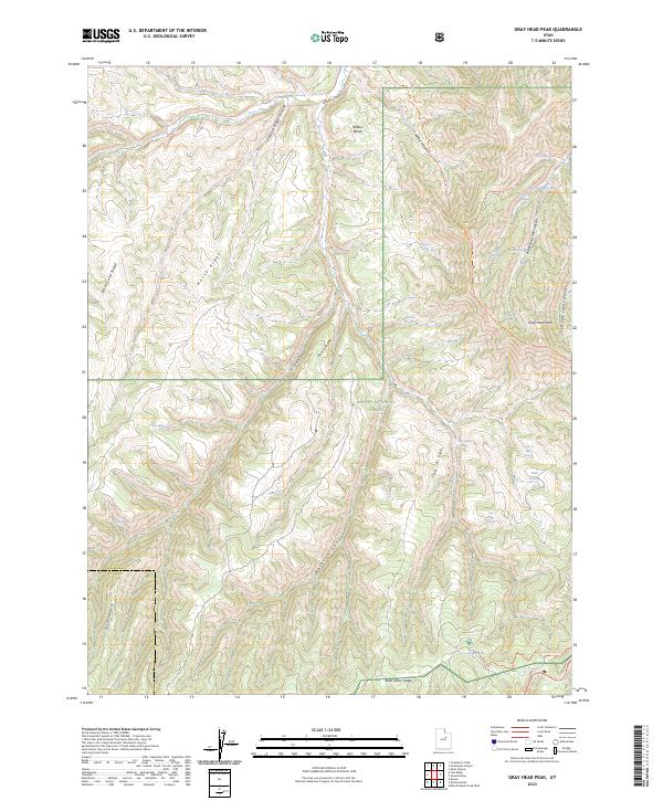
2023 Map of Gray Head Peak
USGS Topo · Published 2023About this map
Ashley National Forest covers the majority of this high-altitude terrain where the boundaries of Duchesne Co and Utah Co meet. The landscape is defined by a series of prominent north-south ridges, including Fossil Ridge, Horse Ridge, and Tub Ridge, which separate deep drainages like Avintaquin Canyon and Reserve Canyon. At the heart of the sheet, Gray Head Peak stands as a primary landmark overlooking the complex network of spring-fed draws that characterize this part of the Uinta Basin's southern rim.
Find a feature on this map
36 named features on this map. Tap any name to fly to it.
Don’t see what you’re looking for? This feature index may not catch every label — zoom into the map to look around manually.
Map Details
Editions of this 2023 Gray Head Peak Map
This is the sole edition of this map. No revisions or reprints were ever made.
Other maps of this area

1885 · Uinta
USGS Topo · 1:250,000

1886 · Price River
USGS Topo · 1:250,000

1896 · Price River
USGS Topo · 1:250,000

1954 · Salt Lake City
USGS Topo · 1:250,000

1956 · Price
USGS Topo · 1:250,000

1958 · Salt Lake City
USGS Topo · 1:250,000

1960 · Salt Lake City
USGS Topo · 1:250,000

1960 · Price
USGS Topo · 1:250,000

1962 · Price
USGS Topo · 1:250,000
1962 · Sams Canyon
USGS Topo · 1:24,000