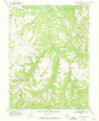
1969 Map of Gray Head Peak
USGS Topo · Published 1971About this map
Ashley National Forest and the Uintah and Ouray Indian Reservation dominate this high-elevation landscape, where the jagged line of the Old Indian Treaty Boundary marks a historical division across the terrain. The area is defined by massive topographic features like Horse Ridge, Little Horse Ridge, and Fossil Ridge, which funnel seasonal drainage into deep corridors such as Avintaquin Canyon and Wilbur Canyon.
Find a feature on this map
47 named features on this map. Tap any name to fly to it.
Don’t see what you’re looking for? This feature index may not catch every label — zoom into the map to look around manually.
Map Details
Editions of this 1969 Gray Head Peak Map
This is the sole edition of this map. No revisions or reprints were ever made.
Other maps of this area

1885 · Uinta
USGS Topo · 1:250,000

1886 · Price River
USGS Topo · 1:250,000

1896 · Price River
USGS Topo · 1:250,000

1954 · Salt Lake City
USGS Topo · 1:250,000

1956 · Price
USGS Topo · 1:250,000

1958 · Salt Lake City
USGS Topo · 1:250,000

1960 · Salt Lake City
USGS Topo · 1:250,000

1960 · Price
USGS Topo · 1:250,000

1962 · Price
USGS Topo · 1:250,000
1962 · Sams Canyon
USGS Topo · 1:24,000