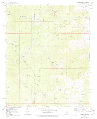
1980 Map of Grayback Mts.
USGS Topo · Published 1980About this map
Grayback Mountains dominate this arid landscape along the Mohave and Yavapai County line during the 1970s. The region is defined by a complex drainage system where Burro Creek and Boulder Creek meet, carved out by numerous seasonal washes like Suicide Wash and Manual Wash. Prospecting and resource extraction are evident across the terrain, with operations such as the Bland Mine, Coors Mine, and the Zannaropolis Mine situated near the heights of Round Mountain.
Find a feature on this map
35 named features on this map. Tap any name to fly to it.
Don’t see what you’re looking for? This feature index may not catch every label — zoom into the map to look around manually.
Map Details
Editions of this 1980 Grayback Mts. Map
This is the sole edition of this map. No revisions or reprints were ever made.
Other maps of this area

1923 · Signal
USGS Topo · 1:250,000

1942 · Signal
USGS Topo · 1:250,000

1945 · Bagdad
USGS Topo · 1:62,500

1948 · Bagdad
USGS Topo · 1:62,500

1950 · Prescott
USGS Topo · 1:250,000

1954 · Prescott
USGS Topo · 1:250,000

1958 · Prescott
USGS Topo · 1:250,000

1959 · Prescott
USGS Topo · 1:250,000

1960 · Prescott
USGS Topo · 1:250,000

1965 · Prescott
USGS Topo · 1:250,000