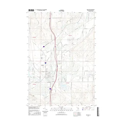
2017 Map of Grayling
USGS Topo · Published 2017About this map
The town of Grayling serves as a central hub for this portion of Crawford County, where the renowned Au Sable River and its East Branch converge. This 2017 survey details a landscape where recreational and military interests meet, featuring the sprawling Hartwick Pines State Park to the north and the Grayling Army Airfield to the west. For genealogists, the map identifies both Elmwood Cem and Old Elmwood Cem, providing precise locations for local heritage research. The presence of the Shore to Shore Trail and the Weary Legs Trail indicates the long-standing importance of this region for outdoorsmen. Beyond the town center, numerous glacial lakes like Shellenbarger Lake, Bright Lake, and Hartwick Lake dot the terrain, while the McNamara Monument stands as a notable landmark near the airfield.
Find a feature on this map
119 named features on this map. Tap any name to fly to it.
Don’t see what you’re looking for? This feature index may not catch every label — zoom into the map to look around manually.
Map Details
Editions of this 2017 Grayling Map
This is the sole edition of this map. No revisions or reprints were ever made.
Other maps of this area

1949 · Otsego Lake
USGS Topo · 1:62,500

1949 · Fletcher
USGS Topo · 1:62,500

1949 · Grayling
USGS Topo · 1:62,500

1950 · Cote Dame Marie
USGS Topo · 1:24,000

1950 · Lake Margrethe
USGS Topo · 1:24,000

1950 · Grayling
USGS Topo · 1:24,000

1950 · Roscommon North
USGS Topo · 1:24,000

1951 · K P Lake
USGS Topo · 1:24,000

1951 · Big Bradford Lake
USGS Topo · 1:24,000

1951 · Wakeley Lake
USGS Topo · 1:24,000
Featured Places
- Grayling, MI
- Frederic Township, MI
- Grayling Charter Township, MI
- Louis Cabin Landing, MI
- Crawford County, MI