
1951 Map of Grayling
USGS Topo · Published 1951About this map
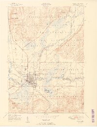
Grayling serves as the hub of this 1951 survey, situated at the junction of the New York Central railroad and the Au Sable River. The map reveals a landscape heavily dedicated to conservation and military use, with the sprawling Camp Grayling Military Reservation dominating the central terrain. To the north, Hartwick Pines State Park preserves a significant timber heritage, evidenced by the Lumbermens Museum and Major Hartwick Museum.
Find a feature on this map
32 named features on this map. Tap any name to fly to it.
Don’t see what you’re looking for? This feature index may not catch every label — zoom into the map to look around manually.
Map Details
Editions of this 1951 Grayling Map
2 editions found
Other maps of this area

1949 · Otsego Lake
USGS Topo · 1:62,500

1949 · Fletcher
USGS Topo · 1:62,500

1949 · Grayling
USGS Topo · 1:62,500

1950 · Cote Dame Marie
USGS Topo · 1:24,000

1950 · Lake Margrethe
USGS Topo · 1:24,000

1950 · Grayling
USGS Topo · 1:24,000

1950 · Roscommon North
USGS Topo · 1:24,000

1951 · K P Lake
USGS Topo · 1:24,000

1951 · Big Bradford Lake
USGS Topo · 1:24,000

1951 · Wakeley Lake
USGS Topo · 1:24,000
Featured Places
- Grayling, MI
- Frederic Township, MI
- Grayling Charter Township, MI
- Louis Cabin Landing, MI
- Crawford County, MI