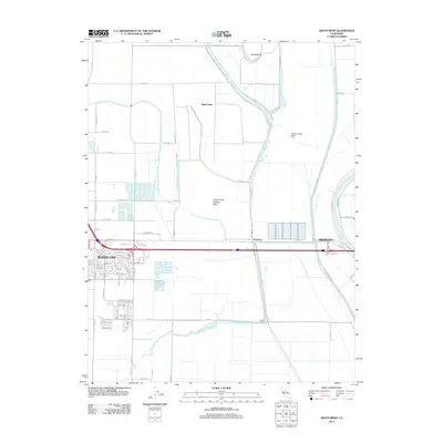
2012 Map of Grays Bend
USGS Topo · Published 2012About this map
Agricultural lands and water management systems dominate this region east of Woodland in the early 21st century. The landscape is defined by the massive Cache Creek Settling Basin and the Knights Landing Ridge Cut, engineered features designed to manage heavy runoff and sediment before it reaches the Sacramento River. To the north, Grays Bend marks a distinctive curve in the river channel near the edge of the Cache Creek Sink, illustrating the complex hydrology of the Yolo Basin.
Find a feature on this map
61 named features on this map. Tap any name to fly to it.
Don’t see what you’re looking for? This feature index may not catch every label — zoom into the map to look around manually.
Map Details
Editions of this 2012 Grays Bend Map
This is the sole edition of this map. No revisions or reprints were ever made.
Other maps of this area

1907 · Dunnigan
USGS Topo · 1:62,500

1907 · Woodland
USGS Topo · 1:62,500

1907 · Davisville
USGS Topo · 1:62,500

1910 · Knights Landing
USGS Topo · 1:31,680

1910 · Vernon
USGS Topo · 1:31,680

1915 · Yolo
USGS Topo · 1:31,680

1915 · Swingle
USGS Topo · 1:31,680

1915 · Ronda
USGS Topo · 1:31,680
1915 · Elkhorn Weir
USGS Topo · 1:31,680

1915 · Merritt
USGS Topo · 1:31,680