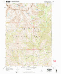
1967 Map of Grays Peak
USGS Topo · Published 1971About this map
The Pioneer Mountains define this high-altitude landscape along the border of Custer and Blaine counties, where mining and wilderness preservation intersect. Surveyed in the late 1960s, the map identifies several significant mineral sites, including the Sunshine Mine, Mascot Mine, and Iron Mine, situated within the rugged drainages of the Sawtooth National Forest. This area serves as a hydrological divide, feeding the Little Wood River and Wildhorse Creek. The terrain is characterized by dramatic peaks like Old Hyndman Pk and the namesake Grays Peak, interspersed with alpine water bodies such as Arrowhead Lake and Windy Lake. A network of pack trails, including the TP Trail, suggests the continued reliance on traditional access routes for forest management and mineral exploration during this era, while the overlap with the Challis National Forest highlights the complex administrative boundaries of Idaho's central wilderness.
Find a feature on this map
49 named features on this map. Tap any name to fly to it.
Don’t see what you’re looking for? This feature index may not catch every label — zoom into the map to look around manually.
Map Details
Editions of this 1967 Grays Peak Map
3 editions found
Other maps of this area

1895 · Hailey
USGS Topo · 1:125,000

1897 · Hailey
USGS Topo · 1:125,000

1935 · MacKay
USGS Topo · 1:96,000

1955 · Idaho Falls
USGS Topo · 1:250,000

1955 · Hailey
USGS Topo · 1:250,000

1958 · Idaho Falls
USGS Topo · 1:250,000

1959 · Hailey
USGS Topo · 1:250,000

1960 · Muldoon Canyon
USGS Topo · 1:62,500

1960 · Copper Basin
USGS Topo · 1:62,500

1962 · Hailey
USGS Topo · 1:250,000