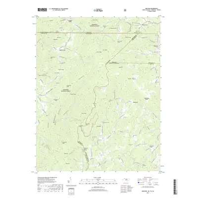
2019 Map of Grayson
USGS Topo · Published 2019About this map
Grayson and Flatwood sit at the tri-state convergence of North Carolina, Tennessee, and Virginia, where the high ridges of the Blue Ridge Mountains create a complex network of gaps and hollows. The landscape is defined by the Tennessee Valley Divide, with waters flowing through the Big Laurel Cr and Roaring Fork systems. This region, encompassing portions of the Jefferson National Forest and Cherokee National Forest, preserves numerous family burial grounds including Allen Cem, Shumate Cem, and the Burnt School Cem. The mapping of these remote upland communities reflects a persistent rural settlement pattern where roads like N Flatwoods Rd and Taylor Valley Rd follow the natural contours of the land. Significant geological features such as Whitetop, Bald Knob, and Fodderstack Mtn anchor the high-elevation terrain, while the Virginia Creeper trail route provides a window into the area's historical transportation corridors.
Find a feature on this map
147 named features on this map. Tap any name to fly to it.
Don’t see what you’re looking for? This feature index may not catch every label — zoom into the map to look around manually.
Map Details
Editions of this 2019 Grayson Map
This is the sole edition of this map. No revisions or reprints were ever made.
Other maps of this area

1891 · Abingdon
USGS Topo · 1:125,000

1893 · Cranberry
USGS Topo · 1:125,000

1894 · Abingdon
USGS Topo · 1:125,000

1895 · Cranberry
USGS Topo · 1:125,000

1899 · Cranberry
USGS Topo · 1:125,000

1902 · Cranberry
USGS Topo · 1:125,000

1909 · Abingdon
USGS Topo · 1:96,000

1911 · Abingdon
USGS Topo · 1:125,000

1935 · Konnarock
USGS Topo · 1:24,000

1935 · Grayson
USGS Topo · 1:24,000