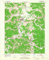
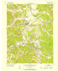
1953 Map of Grayson
USGS Topo · Published 1967About this map
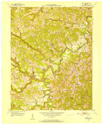
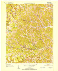
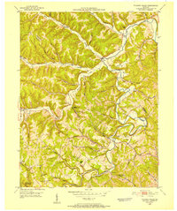
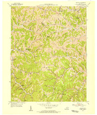
Kentucky Christian College stands at the heart of Grayson, a community situated at a bend in the Little Sandy River during the early 1950s. The landscape is deeply carved by numerous hollows and creeks, such as Barrett Creek and Stinson Creek, which dictate the winding paths of the Midland Trail and the Chesapeake and Ohio railroad. This survey captures the rural infrastructure of Carter County before modern highway expansion, preserving the locations of numerous family cemeteries and local institutions including Lindsey Chapel and the Savage Memorial Ch. Industry is noted by a Fire Clay Pit and a Clay Furnace near Mt Savage, indicating the importance of local mineral resources. The map also documents a dense network of country schools like Locust Sch and Buckeye Sch, providing a detailed look at the social geography of the area.
Find a feature on this map
78 named features on this map. Tap any name to fly to it.
Don’t see what you’re looking for? This feature index may not catch every label — zoom into the map to look around manually.
Map Details
Editions of this 1953 Grayson Map
2 editions found
Other maps of this area

1903 · Kenova
USGS Topo · 1:125,000

1904 · Kenova
USGS Topo · 1:125,000
1950 · Bruin
USGS Topo · 1:24,000
1950 · Grahn
USGS Topo · 1:24,000
1950 · Tygarts Valley
USGS Topo · 1:24,000
1953 · Grayson
USGS Topo · 1:24,000
1953 · Oldtown
USGS Topo · 1:24,000
1953 · Rush
USGS Topo · 1:24,000
1953 · Argillite
USGS Topo · 1:24,000
1953 · Webbville
USGS Topo · 1:24,000