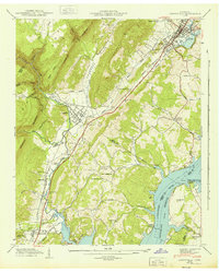
1943 Map of Graysville
USGS Topo · Published 1943About this map
The Cumberland Escarpment looms over the Tennessee Valley in this mid-century survey, defining a sharp boundary between the plateau and the fertile lowlands. The landscape is dominated by the Tennessee River Hiwassee River Reservoir, where the newly formed waters of the Chickamauga Reservation meet the mouth of the Hiwassee. Along the western edge, the Southern railroad corridor connects industrial nodes like Dayton and Graysville, paralleled by the Lon Foust Highway. This 1942 field examination captures the region as it adapted to the massive hydrological changes of the TVA era. Numerous rural landmarks provide essential data for genealogists, including the New Providence Sch, Mt Vernon Ch, and several family burial grounds such as the Old Browder Cem and Abel Cem. The transition from the high ridges of Lone Mountain to the floodplain at Sale Creek illustrates the complex geography of Rhea and Hamilton counties.
Find a feature on this map
56 named features on this map. Tap any name to fly to it.
Don’t see what you’re looking for? This feature index may not catch every label — zoom into the map to look around manually.
Map Details
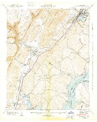
Editions of this 1943 Graysville Map
2 editions found
Other maps of this area

1886 · Cleveland
USGS Topo · 1:125,000

1887 · Kingston
USGS Topo · 1:125,000

1888 · Chattanooga
USGS Topo · 1:125,000

1891 · Kingston
USGS Topo · 1:125,000

1892 · Pikeville
USGS Topo · 1:125,000

1892 · Cleveland
USGS Topo · 1:125,000

1893 · Chattanooga
USGS Topo · 1:125,000

1893 · Kingston
USGS Topo · 1:125,000

1895 · Cleveland
USGS Topo · 1:125,000

1895 · Pikeville
USGS Topo · 1:125,000