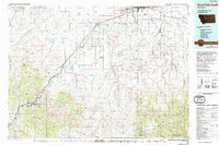
1976 Map of Great Falls South
USGS Topo · Published 1994About this map
Missouri River loops through the heart of this mid-1970s landscape, serving as a primary corridor for the Burlington Northern railroad and Interstate 15. The map documents a transition from the urban infrastructure of Great Falls and Malmstrom A F B to the high-elevation terrain of the Lewis and Clark National Forest and the Little Belt Mountains. Southeast of the city, a cluster of coal-mining era settlements including Stockett, Centerville, Tracy, and the uniquely named Number Seven highlight the industrial history of the Sand Coulee drainage. The western portion of the sheet is defined by striking geological formations such as Square Butte, Crown Butte, and the distinctive Birdtail Divide, while the Sun River Bench provides a flat agricultural contrast to the Sawteeth and Pinnacles found further south.
Find a feature on this map
73 named features on this map. Tap any name to fly to it.
Don’t see what you’re looking for? This feature index may not catch every label — zoom into the map to look around manually.
Map Details
Editions of this 1976 Great Falls South Map
This is the sole edition of this map. No revisions or reprints were ever made.
Other maps of this area

1886 · Great Falls
USGS Topo · 1:250,000

1886 · Fort Logan
USGS Topo · 1:250,000

1886 · Little Belt Mts.
USGS Topo · 1:250,000

1889 · Helena
USGS Topo · 1:250,000

1890 · Fort Benton
USGS Topo · 1:250,000

1892 · Fort Benton
USGS Topo · 1:250,000

1893 · Helena
USGS Topo · 1:250,000

1894 · Little Belt Mts.
USGS Topo · 1:250,000

1897 · Fort Benton
USGS Topo · 1:250,000

1897 · Little Belt Mts.
USGS Topo · 1:250,000