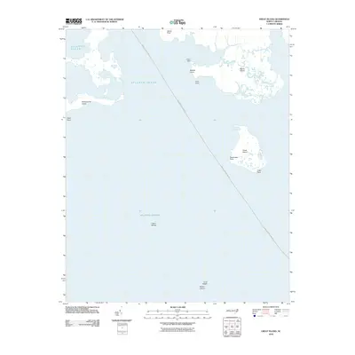
2010 Map of Great Island
USGS Topo · Published 2010About this map
The Swan Quarter-Ocracoke ferry route cuts a long diagonal across this coastal landscape, connecting the mainland of Hyde County to the Outer Banks. This maritime environment is defined by low-lying landforms like Great Island and Swanquarter Island, which sit amidst the open waters of the Atlantic Ocean. The map documents a fragile coastal geography where marshy outposts such as Marsh Island and numerous points, including Crab Point, Drum Point, and Sandy Point, serve as primary landmarks for navigation.
Find a feature on this map
16 named features on this map. Tap any name to fly to it.
Don’t see what you’re looking for? This feature index may not catch every label — zoom into the map to look around manually.
Map Details
Editions of this 2010 Great Island Map
This is the sole edition of this map. No revisions or reprints were ever made.
Other maps of this area

1951 · Brant Island
USGS Topo · 1:24,000
1951 · Bluff Point
USGS Topo · 1:24,000

1951 · Pamlico Point
USGS Topo · 1:24,000

1951 · Great Island
USGS Topo · 1:24,000

1951 · Scranton
USGS Topo · 1:24,000

1951 · New Holland
USGS Topo · 1:24,000

1951 · Swanquarter
USGS Topo · 1:24,000

1953 · Rocky Mount
USGS Topo · 1:250,000

1954 · Rocky Mount
USGS Topo · 1:250,000
1985 · Bayboro
USGS Topo · 1:100,000