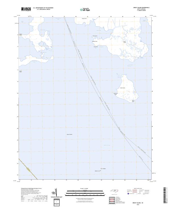
2022 Map of Great Island
USGS Topo · Published 2022About this map
The Ocracoke - Swan Quarter Ferry cuts a long diagonal across the open waters of Pamlico Sound, serving as a vital maritime link between the mainland and the Outer Banks. This coastal environment is defined by an intricate network of marshes and bays, where Swanquarter Bay and Deep Bay meet the sound. The presence of features like Old Haulover suggests the historical necessity of navigating these shallow, shifting waters, while named landmasses such as Judith Island, Marsh Island, and Great Island provide critical landmarks for local mariners.
Find a feature on this map
26 named features on this map. Tap any name to fly to it.
Don’t see what you’re looking for? This feature index may not catch every label — zoom into the map to look around manually.
Map Details
Editions of this 2022 Great Island Map
This is the sole edition of this map. No revisions or reprints were ever made.
Other maps of this area

1951 · Brant Island
USGS Topo · 1:24,000
1951 · Bluff Point
USGS Topo · 1:24,000

1951 · Pamlico Point
USGS Topo · 1:24,000

1951 · Great Island
USGS Topo · 1:24,000

1951 · Scranton
USGS Topo · 1:24,000

1951 · New Holland
USGS Topo · 1:24,000

1951 · Swanquarter
USGS Topo · 1:24,000

1953 · Rocky Mount
USGS Topo · 1:250,000

1954 · Rocky Mount
USGS Topo · 1:250,000
1985 · Bayboro
USGS Topo · 1:100,000