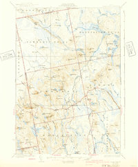
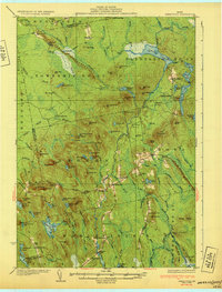
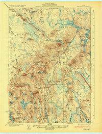
1932 Map of Great Pond
USGS Topo · Published 1940About this map
Amherst and North Mariaville anchor the settled portions of this interior Maine landscape, which was surveyed at the end of the 1920s. The region is defined by the West Branch Union River and a dense network of glacial features, most notably the prominent Horseback ridge stretching through the center of the sheet. Further east, the remote Great Pond P O serves as a small hub near the namesake Great Pond and Long Pond.
Find a feature on this map
119 named features on this map. Tap any name to fly to it.
Don’t see what you’re looking for? This feature index may not catch every label — zoom into the map to look around manually.
Map Details
Editions of this 1932 Great Pond Map
4 editions found

Other maps of this area

1900 · Orland
USGS Topo · 1:62,500

1902 · Orono
USGS Topo · 1:62,500

1911 · Ellsworth
USGS Topo · 1:62,500

1917 · Passadumkeag
USGS Topo · 1:62,500

1929 · Great Pond
USGS Topo · 1:48,000

1929 · Lead Mountain
USGS Topo · 1:48,000

1930 · Tunk Lake
USGS Topo · 1:48,000

1931 · Saponac
USGS Topo · 1:48,000

1932 · Tunk Lake
USGS Topo · 1:62,500

1932 · Nicatous Lake
USGS Topo · 1:48,000