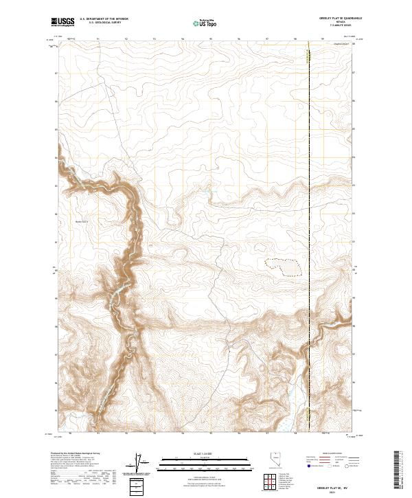
2021 Map of Greeley Flat SE
USGS Topo · Published 2021About this map
The North Fork Little Humboldt River carves a deep, winding canyon through the high plateau of northern Nevada, defining the rugged character of this corner of the Owyhee Desert. This 2021 survey documents the intersection of natural drainage and human management in a remote landscape, where the Humboldt Co Elko Co boundary line runs through an area of expansive rangeland. The waterway is joined by seasonal flows such as Milligan Cr, which cuts through the southeastern terrain. Significant for its water management features, the map identifies the New Reservoir and the distinct geographic landmark known as North Fork V. The land is meticulously gridded for the Public Land Survey System, showing the township boundaries of T43N and T42N, which are vital for understanding historical land claims and grazing allotments in this high-desert environment.
Find a feature on this map
10 named features on this map. Tap any name to fly to it.
Don’t see what you’re looking for? This feature index may not catch every label — zoom into the map to look around manually.
Map Details
Editions of this 2021 Greeley Flat SE Map
This is the sole edition of this map. No revisions or reprints were ever made.
Other maps of this area

1882 · Paradise
USGS Topo · 1:250,000

1893 · Paradise
USGS Topo · 1:250,000

1955 · McDermitt
USGS Topo · 1:250,000

1959 · McDermitt
USGS Topo · 1:250,000
1973 · Rodear Flat
USGS Topo · 1:24,000

1973 · Button Lake Well
USGS Topo · 1:24,000

1973 · Humboldt Hill
USGS Topo · 1:24,000
1980 · Layton Spring
USGS Topo · 1:24,000
1980 · Button Lake
USGS Topo · 1:24,000

1980 · Greeley Flat
USGS Topo · 1:24,000