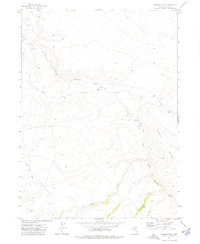
1973 Map of Rodear Flat
USGS Topo · Published 1977About this map
Little Humboldt River and its South Fork dominate this high-desert landscape in Elko County, mapping a network of drainages and seasonal water sources. The map captures a moment in the early 1970s where ranching infrastructure remains the primary human footprint in this isolated terrain. Evidence of local livestock management appears at Castle Place and a nearby Corral, while the wide expanse of Rodear Flat suggests its use as a natural gathering point for cattle. Navigation through the area is defined by a sparse system of Jeep Trails that follow the contours of Castle Ridge and descend into the First Creek Basin. This survey provides essential detail for understanding the hydrological patterns of the northern Great Basin, tracking the path of Snowstorm Creek and various unnamed Spring locations that sustained the region's ranching economy.
Find a feature on this map
11 named features on this map. Tap any name to fly to it.
Don’t see what you’re looking for? This feature index may not catch every label — zoom into the map to look around manually.
Map Details
Editions of this 1973 Rodear Flat Map
This is the sole edition of this map. No revisions or reprints were ever made.
Other maps of this area

1882 · Paradise
USGS Topo · 1:250,000

1893 · Paradise
USGS Topo · 1:250,000

1955 · McDermitt
USGS Topo · 1:250,000

1959 · McDermitt
USGS Topo · 1:250,000

1973 · Snowstorm Mtn
USGS Topo · 1:24,000

1973 · McCleary Wells
USGS Topo · 1:24,000

1973 · Haystack Peak
USGS Topo · 1:24,000

1973 · Humboldt Hill
USGS Topo · 1:24,000
1977 · Oregon Canyon
USGS Topo · 1:24,000
1980 · Layton Spring
USGS Topo · 1:24,000