1977 Map of Oregon Canyon
USGS Topo · Published 1978About this map
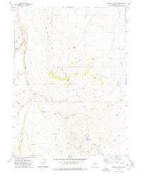
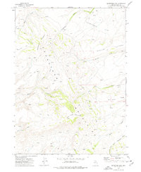
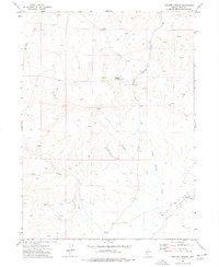
Castle Ridge dominates this northern Nevada landscape, where the high desert terrain is carved by the South Fork Little Humboldt River and its numerous tributaries. In the late 1970s, the area's mining legacy remained visible in the southeastern corner, where several workings such as the Elko Prince Mine and Miners Gold Mine are situated along Midas Creek. The presence of the Little Jewel Mine and Blue Bell Mine nearby suggests a once-active district concentrated in this rugged canyon section.
Find a feature on this map
26 named features on this map. Tap any name to fly to it.
Don’t see what you’re looking for? This feature index may not catch every label — zoom into the map to look around manually.
Map Details
Editions of this 1977 Oregon Canyon Map
This is the sole edition of this map. No revisions or reprints were ever made.
Other maps of this area

1955 · McDermitt
USGS Topo · 1:250,000

1959 · McDermitt
USGS Topo · 1:250,000
1965 · Jake Creek Mtn
USGS Topo · 1:24,000
1965 · Squaw Valley Ranch
USGS Topo · 1:24,000
1965 · Midas
USGS Topo · 1:24,000
1973 · Snowstorm Mtn
USGS Topo · 1:24,000
1973 · Rodear Flat
USGS Topo · 1:24,000
1973 · Haystack Peak
USGS Topo · 1:24,000
1974 · Burner Hills
USGS Topo · 1:24,000
1977 · Scraper Springs
USGS Topo · 1:24,000