
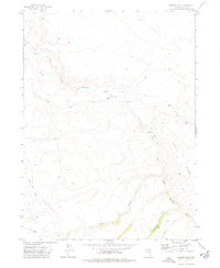
1973 Map of Haystack Peak
USGS Topo · Published 1977About this map
Haystack Peak dominates the high desert landscape of Elko County in this early 1970s topographical survey. The terrain is defined by the sharp elevations of Castle Ridge, where a network of primitive routes like the Pack Trail and various Jeep Trail segments provided the only access through this isolated stretch of Nevada. Water sources are sparse but critical, evidenced by the location of McFadden Spring and the drainage of the Little Humboldt R at the map's western edge.
Find a feature on this map
8 named features on this map. Tap any name to fly to it.
Don’t see what you’re looking for? This feature index may not catch every label — zoom into the map to look around manually.
Map Details
Editions of this 1973 Haystack Peak Map
This is the sole edition of this map. No revisions or reprints were ever made.
Other maps of this area

1955 · McDermitt
USGS Topo · 1:250,000

1959 · McDermitt
USGS Topo · 1:250,000

1973 · Snowstorm Mtn
USGS Topo · 1:24,000
1973 · Rodear Flat
USGS Topo · 1:24,000

1973 · McCleary Wells
USGS Topo · 1:24,000

1973 · Humboldt Hill
USGS Topo · 1:24,000

1974 · Winters Ranch Reservoir
USGS Topo · 1:24,000

1974 · Burner Hills
USGS Topo · 1:24,000

1977 · Scraper Springs
USGS Topo · 1:24,000
1977 · Oregon Canyon
USGS Topo · 1:24,000