
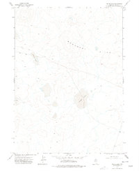
1974 Map of Winters Ranch Reservoir
USGS Topo · Published 1977About this map
Burner Hills rise across this Elko County landscape, defining the topography of this high desert region in the mid-1970s. The area is characterized by sparse water sources and rudimentary transit corridors, most notably the Winters Ranch Reservoir, which is noted as a dry well on this survey. Local drainage is defined by the ephemeral courses of Chimney Creek in the east and Milligan Creek in the southwest corner. The prevalence of a Jeep Trail network winding through the hills suggests a terrain utilized primarily for ranching access or survey work rather than established settlement. Numerous benchmark elevation points throughout the quadrangle provide a fine-grained look at the undulating elevations surrounding the reservoir site.
Find a feature on this map
5 named features on this map. Tap any name to fly to it.
Don’t see what you’re looking for? This feature index may not catch every label — zoom into the map to look around manually.
Map Details
Editions of this 1974 Winters Ranch Reservoir Map
This is the sole edition of this map. No revisions or reprints were ever made.
Other maps of this area

1955 · McDermitt
USGS Topo · 1:250,000

1959 · McDermitt
USGS Topo · 1:250,000

1973 · McCleary Wells
USGS Topo · 1:24,000

1973 · Corral Lake
USGS Topo · 1:24,000

1973 · Haystack Peak
USGS Topo · 1:24,000

1974 · Soldier Cap
USGS Topo · 1:24,000

1974 · Middle Draw Reservoir
USGS Topo · 1:24,000

1974 · Burner Hills
USGS Topo · 1:24,000

1974 · Desert Ranch
USGS Topo · 1:24,000
1977 · Silver Lake
USGS Topo · 1:24,000