
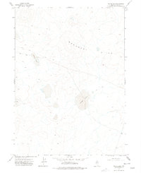
1974 Map of Middle Draw Reservoir
USGS Topo · Published 1977About this map
Middle Draw Reservoir lies at the heart of this high-desert Elko County landscape, serving as a critical water source in a territory defined by seasonal drainages. During the mid-1970s, the area remained largely undeveloped, crisscrossed only by a primitive Jeep Trail and various bench marks that tracked the elevation of this remote terrain. The hydrology of the region is centered on the convergence of Chimney Creek, Winters Creek, and Threemile Creek, which wind through the topography toward the reservoir. A single 5468 Well and the curiously named China feature stand out as lonely markers of human presence or local nomenclature. The prevalence of these watercourses and wells against a backdrop of survey points like BM 5487 and BM 5797 suggests a landscape managed primarily for grazing and resource monitoring rather than permanent settlement.
Find a feature on this map
15 named features on this map. Tap any name to fly to it.
Don’t see what you’re looking for? This feature index may not catch every label — zoom into the map to look around manually.
Map Details
Editions of this 1974 Middle Draw Reservoir Map
This is the sole edition of this map. No revisions or reprints were ever made.
Other maps of this area

1955 · McDermitt
USGS Topo · 1:250,000

1956 · Mt. Blitzen
USGS Topo · 1:62,500

1959 · McDermitt
USGS Topo · 1:250,000

1964 · Wilson Reservoir
USGS Topo · 1:62,500

1974 · Soldier Cap
USGS Topo · 1:24,000

1974 · Winters Ranch Reservoir
USGS Topo · 1:24,000

1974 · Burner Hills
USGS Topo · 1:24,000

1974 · Desert Ranch
USGS Topo · 1:24,000
1977 · Silver Lake
USGS Topo · 1:24,000

1982 · Bull Run Mts
USGS Topo · 1:100,000