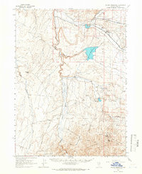
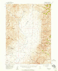
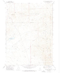
1964 Map of Wilson Reservoir
USGS Topo · Published 1966About this map
YP Ranch and several other historic cattle operations anchor this high-desert landscape in Elko County, reflecting the enduring ranching economy of northern Nevada during the mid-1960s. The northern reaches of the Tuscarora Mts and the prominent Cornucopia Ridge dominate the southern terrain, while water management is central to the area's utility. Significant water bodies include the expansive Wilson Reservoir, Deep Creek Reservoir, and Rawhide Reservoir, which supported the surrounding livestock ranges. Local education and infrastructure are evidenced by the Edgemont Sch and a landing strip near the IL Ranch. The map also traces a network of remote travel routes, including a Jeep Trail cutting through Canyon Creek, highlighting the isolation and utility of the land between the Owyhee River and the rugged basins like Wild Horse Basin.
Find a feature on this map
35 named features on this map. Tap any name to fly to it.
Don’t see what you’re looking for? This feature index may not catch every label — zoom into the map to look around manually.
Map Details
Editions of this 1964 Wilson Reservoir Map
2 editions found
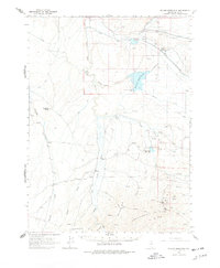
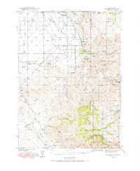
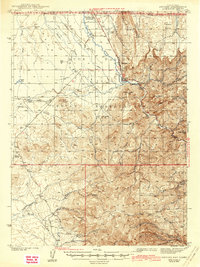
Other maps of this area
1939 · Owyhee
USGS Topo · 1:62,500
1942 · Owyhee
USGS Topo · 1:62,500

1955 · McDermitt
USGS Topo · 1:250,000
1956 · Tuscarora
USGS Topo · 1:62,500
1956 · Mt. Blitzen
USGS Topo · 1:62,500
1956 · Bull Run
USGS Topo · 1:62,500

1959 · McDermitt
USGS Topo · 1:250,000
1964 · Hat Peak
USGS Topo · 1:62,500
1971 · Dry Creek Reservoir
USGS Topo · 1:24,000
1974 · Soldier Cap
USGS Topo · 1:24,000