
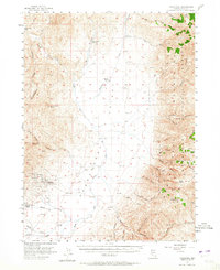
1956 Map of Tuscarora
USGS Topo · Published 1958About this map
Tuscarora sits at the heart of this mid-century survey, surrounded by the clear remnants of a mining economy that shaped northern Elko County. The map documents numerous mining operations scattered across the hills, including the Commonwealth Mine, Queen Mine, and Navajo Mine, alongside several unidentified Prospects. This industrial legacy is contrasted by the established livestock operations on the valley floor, evidenced by the Spanish Ranch and Quarter Circle S Ranch. The South Fork Owyhee River and its many tributaries, such as McCann Creek and Taylor Creek, define the drainage of the Independence Valley. To the east, the terrain rises sharply into the Humboldt National Forest, where high peaks like Jacks Peak and Wheeler Mtn overlook a complex system of canyons. Small-scale features such as the local Cem, a Water Tank, and a Landing Strip near the town center provide specific points of interest for genealogists and local historians.
Find a feature on this map
58 named features on this map. Tap any name to fly to it.
Don’t see what you’re looking for? This feature index may not catch every label — zoom into the map to look around manually.
Map Details
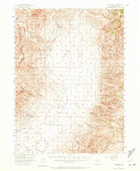
Editions of this 1956 Tuscarora Map
3 editions found
Other maps of this area

1955 · McDermitt
USGS Topo · 1:250,000

1955 · Wells
USGS Topo · 1:250,000

1956 · Mt. Blitzen
USGS Topo · 1:62,500

1956 · Bull Run
USGS Topo · 1:62,500

1956 · Wild Horse
USGS Topo · 1:62,500

1958 · Wells
USGS Topo · 1:250,000

1959 · McDermitt
USGS Topo · 1:250,000

1961 · Wells
USGS Topo · 1:250,000

1964 · Wilson Reservoir
USGS Topo · 1:62,500

1970 · Sugarloaf Butte
USGS Topo · 1:24,000