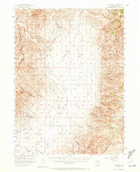
1956 Map of Tuscarora
USGS Topo · Published 1972About this map
Tuscarora sits at the foot of the Independence Mountains, serving as the primary hub for this high-desert mining and ranching landscape during the mid-1950s. The settlement's mining heritage is clearly visible in the surrounding hills, where operations like the Commonwealth Mine, Queen Mine, and Grand Prize Mine are situated near a local Cem and Landing Strip. The map reveals a land divided between industrial extraction and vast livestock operations, with Spanish Ranch and Quarter Circle S Ranch anchoring the open basins.
Find a feature on this map
59 named features on this map. Tap any name to fly to it.
Don’t see what you’re looking for? This feature index may not catch every label — zoom into the map to look around manually.
Map Details
Editions of this 1956 Tuscarora Map
3 editions found
Other maps of this area

1955 · McDermitt
USGS Topo · 1:250,000

1955 · Wells
USGS Topo · 1:250,000

1956 · Tuscarora
USGS Topo · 1:62,500

1956 · Mt. Blitzen
USGS Topo · 1:62,500

1956 · Bull Run
USGS Topo · 1:62,500

1956 · Wild Horse
USGS Topo · 1:62,500

1958 · Wells
USGS Topo · 1:250,000

1959 · McDermitt
USGS Topo · 1:250,000

1961 · Wells
USGS Topo · 1:250,000

1964 · Wilson Reservoir
USGS Topo · 1:62,500