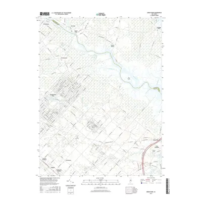
2016 Map of Green Bank
USGS Topo · Published 2016About this map
The Mullica River defines the landscape of this coastal New Jersey corridor, weaving through salt marshes and low-lying wetlands that separate Burlington and Atlantic Counties. Historically significant settlements like Green Bank and Lower Bank sit directly on its banks, reflecting the region's long-standing reliance on riverine transport and the pine barrens' unique ecology. To the south, the grid-pattern streets of Egg Harbor City and Germania illustrate early planned communities and agricultural clusters, where localized history is preserved at the Germania Cem. The eastern edge of the map features the tidal confluence near Port Republic, characterized by water bodies such as Mill Pond and Clarks Mill Stream. Genealogists may find value in the scattered burial sites, including the Clarks Mill Burying Ground and Boling Cem, which mark the presence of early families and established hamlets in this tidal landscape.
Find a feature on this map
164 named features on this map. Tap any name to fly to it.
Don’t see what you’re looking for? This feature index may not catch every label — zoom into the map to look around manually.
Map Details
Editions of this 2016 Green Bank Map
This is the sole edition of this map. No revisions or reprints were ever made.
Other maps of this area

1887 · Atlantic City
USGS Topo · 1:62,500

1888 · Little Egg Harbor
USGS Topo · 1:62,500

1890 · Great Egg Harbor
USGS Topo · 1:62,500

1890 · Mullica
USGS Topo · 1:62,500

1893 · Great Egg Harbor
USGS Topo · 1:62,500

1893 · Little Egg Harbor
USGS Topo · 1:62,500

1894 · Atlantic City
USGS Topo · 1:62,500

1894 · Mullica
USGS Topo · 1:62,500

1898 · Mullica
USGS Topo · 1:62,500

1900 · Rancocas
USGS Topo · 1:125,000
Featured Places
- Galloway Township, NJ
- Mullica Township, NJ
- Egg Harbor City, NJ
- Bass River Township, NJ
- Port Republic, NJ