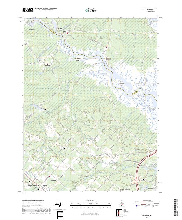
2023 Map of Green Bank
USGS Topo · Published 2023About this map
The Mullica River defines the landscape of this Atlantic County region, winding past historical settlements like Green Bank and Lower Bank. The area is characterized by a dense network of watercourses, including Landing Creek, Indian Cabin Creek, and Clarks Mill Stream, which flow through the marshy terrain of the Hog Islands. Inland, the map reveals the layout of agricultural and residential communities such as Germania and Weekstown, alongside newer developments like Vienna Gardens.
Find a feature on this map
113 named features on this map. Tap any name to fly to it.
Don’t see what you’re looking for? This feature index may not catch every label — zoom into the map to look around manually.
Map Details
Editions of this 2023 Green Bank Map
This is the sole edition of this map. No revisions or reprints were ever made.
Other maps of this area

1887 · Atlantic City
USGS Topo · 1:62,500

1888 · Little Egg Harbor
USGS Topo · 1:62,500

1890 · Great Egg Harbor
USGS Topo · 1:62,500

1890 · Mullica
USGS Topo · 1:62,500

1893 · Great Egg Harbor
USGS Topo · 1:62,500

1893 · Little Egg Harbor
USGS Topo · 1:62,500

1894 · Atlantic City
USGS Topo · 1:62,500

1894 · Mullica
USGS Topo · 1:62,500

1898 · Mullica
USGS Topo · 1:62,500

1900 · Rancocas
USGS Topo · 1:125,000
Featured Places
- Galloway Township, NJ
- Mullica Township, NJ
- Egg Harbor City, NJ
- Bass River Township, NJ
- Port Republic, NJ