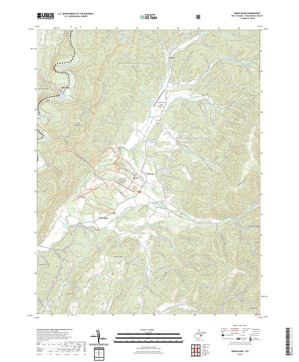
2023 Map of Green Bank
USGS Topo · Published 2023About this map
Deer Creek Valley serves as the central corridor for this part of the Monongahela National Forest, where the small settlements of Arbovale and Green Bank are established. The landscape is defined by its scientific and aviation infrastructure, notably the Green Bank Observatory Airport and nearby Deer Creek Farm Airport, which sit amidst a network of intricate ridge-and-hollow terrain. To the north, the village of Boyer marks the convergence of several mountain runs, while the Greenbrier River and its associated Greenbrier River Trail trace the western edge of the map near Hosterman. The topographic detail reveals a complex system of named ridges like Bowman Ridge and Charley Ridge, interspersed with numerous hollows such as Slavin Hollow and Smith Hollow. Genealogists and local researchers will find the location of the Arbovale Cemetery and the many family-named peaks, including Asbury Knob and Old House Knob, essential for tracing historical land use in this pocket of West Virginia.
Find a feature on this map
72 named features on this map. Tap any name to fly to it.
Don’t see what you’re looking for? This feature index may not catch every label — zoom into the map to look around manually.
Map Details
Editions of this 2023 Green Bank Map
This is the sole edition of this map. No revisions or reprints were ever made.
Other maps of this area

1889 · Beverly
USGS Topo · 1:125,000

1892 · Beverly
USGS Topo · 1:125,000

1901 · Monterey
USGS Topo · 1:125,000

1922 · Spruce Knob
USGS Topo · 1:48,000

1922 · Cass
USGS Topo · 1:48,000

1922 · Durbin
USGS Topo · 1:48,000

1924 · Cass
USGS Topo · 1:62,500

1924 · Durbin
USGS Topo · 1:62,500

1924 · Spruce Knob
USGS Topo · 1:62,500

1941 · Monterey
USGS Topo · 1:62,500