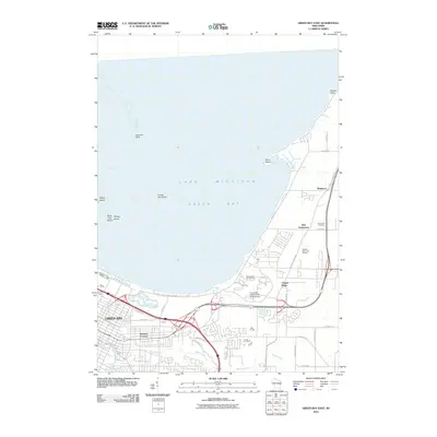
2010 Map of Green Bay East
USGS Topo · Published 2010About this map
Green Bay and the shoreline of Lake Michigan Green Bay define this 2010 survey of the eastern waterfront and its expanding residential neighborhoods. The landscape is marked by the winding path of Baird Creek as it flows toward the city center, while the coast is shaped by distinctive features like Point Sable and the Long Tail Point peninsula. This era shows the established footprint of the University of Wisconsin at Green Bay, situated near the shoreline between the city and the northern rural outskirts.
Find a feature on this map
36 named features on this map. Tap any name to fly to it.
Don’t see what you’re looking for? This feature index may not catch every label — zoom into the map to look around manually.
Map Details
Editions of this 2010 Green Bay East Map
This is the sole edition of this map. No revisions or reprints were ever made.
Other maps of this area

1954 · De Pere
USGS Topo · 1:62,500

1954 · Green Bay West
USGS Topo · 1:24,000

1954 · Denmark
USGS Topo · 1:62,500

1954 · De Pere
USGS Topo · 1:24,000

1954 · New Franken
USGS Topo · 1:62,500

1954 · Green Bay East
USGS Topo · 1:24,000

1954 · Manitowoc
USGS Topo · 1:250,000

1954 · Bellevue
USGS Topo · 1:24,000

1954 · Green Bay
USGS Topo · 1:62,500

1955 · Green Bay
USGS Topo · 1:250,000