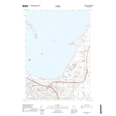
2018 Map of Green Bay East
USGS Topo · Published 2018About this map
Bairds Creek winds through the eastern suburban reaches of Green Bay, illustrating the transition from the city's dense residential grid to the outlying settlements of Brown County. This 2018 survey documents the expansion of neighborhoods like Preble and Chapel Ridge, while preserving the location of older landmarks such as Haevers Corners and Wequiock. The coastal geography is defined by the unique features of Green Bay and Lake Michigan, including the elongated Long Tail Point and the shoals surrounding Grassy Island. Local history researchers will find the placement of County Home Cem and Holy Cross Cem particularly valuable for genealogical study. The map also traces the modern road network, including the path of University Ave as it connects the urban core to the Bay Settlement area, reflecting the contemporary landscape of this significant Wisconsin port city.
Find a feature on this map
128 named features on this map. Tap any name to fly to it.
Don’t see what you’re looking for? This feature index may not catch every label — zoom into the map to look around manually.
Map Details
Editions of this 2018 Green Bay East Map
This is the sole edition of this map. No revisions or reprints were ever made.
Other maps of this area

1954 · De Pere
USGS Topo · 1:62,500

1954 · Green Bay West
USGS Topo · 1:24,000

1954 · Denmark
USGS Topo · 1:62,500

1954 · De Pere
USGS Topo · 1:24,000

1954 · New Franken
USGS Topo · 1:62,500

1954 · Green Bay East
USGS Topo · 1:24,000

1954 · Manitowoc
USGS Topo · 1:250,000

1954 · Bellevue
USGS Topo · 1:24,000

1954 · Green Bay
USGS Topo · 1:62,500

1955 · Green Bay
USGS Topo · 1:250,000