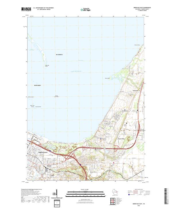
2022 Map of Green Bay East
USGS Topo · Published 2022About this map
Green Bay and its northeastern expansion define this coastal landscape where the waters of Green Bay meet the eastern shore of Lake Michigan. The map details a transition from dense urban street grids, including Radisson St and University Ave, to the more dispersed communities of Bay Settlement and Wequiock. Local history is anchored by sites like Holy Cross Cem and the Gershwin Dr Potters Field Cem, which speak to the area's social history. The shoreline is defined by notable coastal landforms such as Long Tail Point, Point Sable, and the Frying Pan Shoal. Inland, the winding path of Baird Creek cuts through the terrain near Preble and Haevers Corners, while the campus of the University of Wisconsin - Green Bay occupies a prominent position overlooking the water.
Find a feature on this map
132 named features on this map. Tap any name to fly to it.
Don’t see what you’re looking for? This feature index may not catch every label — zoom into the map to look around manually.
Map Details
Editions of this 2022 Green Bay East Map
This is the sole edition of this map. No revisions or reprints were ever made.
Other maps of this area

1954 · De Pere
USGS Topo · 1:62,500

1954 · Green Bay West
USGS Topo · 1:24,000

1954 · Denmark
USGS Topo · 1:62,500

1954 · De Pere
USGS Topo · 1:24,000

1954 · New Franken
USGS Topo · 1:62,500

1954 · Green Bay East
USGS Topo · 1:24,000

1954 · Manitowoc
USGS Topo · 1:250,000

1954 · Bellevue
USGS Topo · 1:24,000

1954 · Green Bay
USGS Topo · 1:62,500

1955 · Green Bay
USGS Topo · 1:250,000