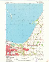
1982 Map of Green Bay East
USGS Topo · Published 1982About this map
Green Bay and the northeastern Wisconsin shoreline are documented here in the early 1980s, showcasing the expansion of the city alongside its maritime and academic infrastructure. The urban core, characterized by the East River and the industrial activity near the Oil Tanks and Sewage Disposal, transitions into residential neighborhoods like Haevers Corners and Chapel Ridge. Educational and social institutions are prominent features, most notably the University of Wisconsin-Green Bay campus and various religious landmarks such as Holy Cross Church in Bay Settlement.
Find a feature on this map
53 named features on this map. Tap any name to fly to it.
Don’t see what you’re looking for? This feature index may not catch every label — zoom into the map to look around manually.
Map Details
Editions of this 1982 Green Bay East Map
This is the sole edition of this map. No revisions or reprints were ever made.
Other maps of this area

1954 · De Pere
USGS Topo · 1:62,500

1954 · Green Bay West
USGS Topo · 1:24,000

1954 · Denmark
USGS Topo · 1:62,500

1954 · De Pere
USGS Topo · 1:24,000

1954 · New Franken
USGS Topo · 1:62,500

1954 · Green Bay East
USGS Topo · 1:24,000

1954 · Manitowoc
USGS Topo · 1:250,000

1954 · Bellevue
USGS Topo · 1:24,000

1954 · Green Bay
USGS Topo · 1:62,500

1955 · Green Bay
USGS Topo · 1:250,000