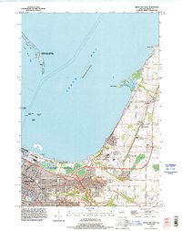
1992 Map of Green Bay East
USGS Topo · Published 1996About this map
The eastern shore of Green Bay and the mouth of the East River dominate this early 1990s landscape, illustrating the suburban and institutional growth of Green Bay and the village of Bay Settlement. The city's northward expansion along Nicolet Drive is anchored by the sprawling campus of the University of Wisconsin Green Bay and several large cemeteries, including Nicolet Memorial Gardens and the County Home Cemetery.
Find a feature on this map
52 named features on this map. Tap any name to fly to it.
Don’t see what you’re looking for? This feature index may not catch every label — zoom into the map to look around manually.
Map Details
Editions of this 1992 Green Bay East Map
This is the sole edition of this map. No revisions or reprints were ever made.
Other maps of this area

1954 · De Pere
USGS Topo · 1:62,500

1954 · Green Bay West
USGS Topo · 1:24,000

1954 · Denmark
USGS Topo · 1:62,500

1954 · De Pere
USGS Topo · 1:24,000

1954 · New Franken
USGS Topo · 1:62,500

1954 · Green Bay East
USGS Topo · 1:24,000

1954 · Manitowoc
USGS Topo · 1:250,000

1954 · Bellevue
USGS Topo · 1:24,000

1954 · Green Bay
USGS Topo · 1:62,500

1955 · Green Bay
USGS Topo · 1:250,000