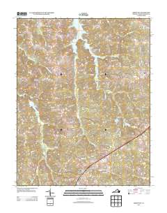
2013 Map of Green Bay
USGS Topo · Published 2013About this map
The community of Green Bay serves as a southern anchor for this Prince Edward County landscape, where the headwaters of the Sandy River and its numerous tributaries like Weaver Cr and Flippen Cr carve through the terrain. The northern reaches are defined by a network of significant water bodies, including Hicks Lake, Miller Lake, and Goodwin Lake, the latter situated near Prince Edward Lake in a densely wooded corridor. This area reflects a deep-rooted rural character, with the Prince Edward-Gallion SF preserving a large tract of the native forest. Prominent elevations like Leigh Mountain rise above the drainage basins of Cunninghams Cr and Mountain Cr, while scattered settlements like Moran are linked by a complex web of timber and farm roads such as Green Bay Rd and Sandy River Rd.
Find a feature on this map
88 named features on this map. Tap any name to fly to it.
Don’t see what you’re looking for? This feature index may not catch every label — zoom into the map to look around manually.
Map Details
Editions of this 2013 Green Bay Map
This is the sole edition of this map. No revisions or reprints were ever made.
Other maps of this area

1891 · Farmville
USGS Topo · 1:125,000

1893 · Farmville
USGS Topo · 1:125,000

1947 · Roanoke
USGS Topo · 1:250,000

1958 · Farmville
USGS Topo · 1:62,500

1958 · Jetersville
USGS Topo · 1:62,500

1958 · Crewe
USGS Topo · 1:62,500

1958 · Keysville
USGS Topo · 1:62,500

1959 · Roanoke
USGS Topo · 1:250,000

1963 · Roanoke
USGS Topo · 1:250,000
1968 · Farmville
USGS Topo · 1:24,000