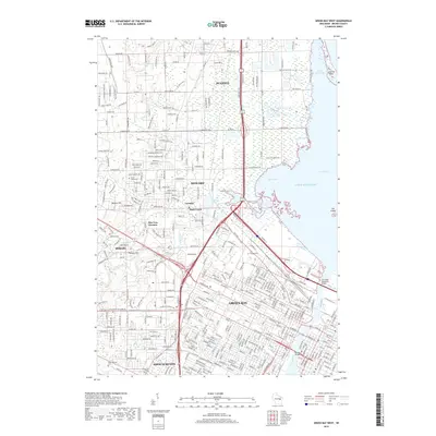
2018 Map of Green Bay West
USGS Topo · Published 2018About this map
The Fox River and East River converge in this 2018 survey, defining the industrial and urban heart of Green Bay at the edge of Lake Michigan. The landscape transitions from the dense street grids of the city to the suburban developments of Ashwaubenon and Howard, while the northern reaches near Suamico remain characterized by coastal marshes and the sprawling waters of Green Bay. Historic landmarks and burial grounds like Fort Howard Cem and Saint Johns Cem provide essential anchor points for local genealogy and history.
Find a feature on this map
340 named features on this map. Tap any name to fly to it.
Don’t see what you’re looking for? This feature index may not catch every label — zoom into the map to look around manually.
Map Details
Editions of this 2018 Green Bay West Map
This is the sole edition of this map. No revisions or reprints were ever made.
Other maps of this area

1954 · De Pere
USGS Topo · 1:62,500

1954 · Green Bay West
USGS Topo · 1:24,000

1954 · Denmark
USGS Topo · 1:62,500

1954 · De Pere
USGS Topo · 1:24,000

1954 · New Franken
USGS Topo · 1:62,500

1954 · Green Bay East
USGS Topo · 1:24,000

1954 · Manitowoc
USGS Topo · 1:250,000

1954 · Bellevue
USGS Topo · 1:24,000

1954 · Green Bay
USGS Topo · 1:62,500

1955 · Green Bay
USGS Topo · 1:250,000