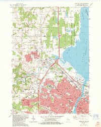
1982 Map of Green Bay West
USGS Topo · Published 1983About this map
The Fox River and East River converge in this detailed mapping of the industrial and residential landscape of the early 1980s. The urban core of Green Bay is centered on the southeast, where major landmarks like Lambeau Field and the Arena anchor the Ashwaubenon area. A significant Indian Reservation Boundary cuts across the western half of the map, separating the growing suburbs of Howard and Elm Tree Corners from the more rural reaches to the north.
Find a feature on this map
90 named features on this map. Tap any name to fly to it.
Don’t see what you’re looking for? This feature index may not catch every label — zoom into the map to look around manually.
Map Details
Editions of this 1982 Green Bay West Map
This is the sole edition of this map. No revisions or reprints were ever made.
Other maps of this area

1954 · De Pere
USGS Topo · 1:62,500

1954 · Green Bay West
USGS Topo · 1:24,000

1954 · Denmark
USGS Topo · 1:62,500

1954 · De Pere
USGS Topo · 1:24,000

1954 · New Franken
USGS Topo · 1:62,500

1954 · Green Bay East
USGS Topo · 1:24,000

1954 · Manitowoc
USGS Topo · 1:250,000

1954 · Bellevue
USGS Topo · 1:24,000

1954 · Green Bay
USGS Topo · 1:62,500

1955 · Green Bay
USGS Topo · 1:250,000