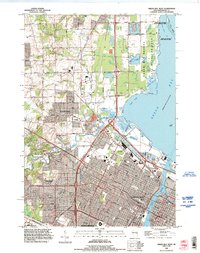
1992 Map of Green Bay West
USGS Topo · Published 1996About this map
The Fox River meets the bay in this detailed landscape, where the urban expansion of Green Bay and Ashwaubenon transitions into the marshy lowlands of the Green Bay Shores State Wildlife Area. This era shows the dense residential platting of Howard and Mather Heights set against the significant industrial and transportation infrastructure of the 1990s, including the Powerplant on the riverbank and the John Antonneau Memorial Airport.
Find a feature on this map
69 named features on this map. Tap any name to fly to it.
Don’t see what you’re looking for? This feature index may not catch every label — zoom into the map to look around manually.
Map Details
Editions of this 1992 Green Bay West Map
This is the sole edition of this map. No revisions or reprints were ever made.
Other maps of this area

1954 · De Pere
USGS Topo · 1:62,500

1954 · Green Bay West
USGS Topo · 1:24,000

1954 · Denmark
USGS Topo · 1:62,500

1954 · De Pere
USGS Topo · 1:24,000

1954 · New Franken
USGS Topo · 1:62,500

1954 · Green Bay East
USGS Topo · 1:24,000

1954 · Manitowoc
USGS Topo · 1:250,000

1954 · Bellevue
USGS Topo · 1:24,000

1954 · Green Bay
USGS Topo · 1:62,500

1955 · Green Bay
USGS Topo · 1:250,000