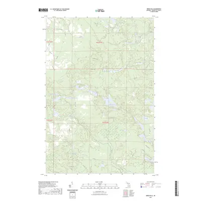
2023 Map of Green Hills
USGS Topo · Published 2023About this map
Green Hills serves as the central point of this interior Marquette County landscape, where the Middle Branch Escanaba River and its numerous tributaries shape the terrain. The map reveals a dense network of forest roads and truck trails, such as Camp Truck Trl and Tower Truck Trl, which provide access to a complex system of glacial lakes and wetlands. The hydrography is dominated by named water bodies including Big Bass Lake, Voelker Lake, and Kidney Lake, often linked by small drainages like Bass Creek and Flopper Creek. The pattern of development here is typical of Upper Peninsula timberlands, defined more by specialized logging roads and seasonal access than by permanent residential settlements. This survey captures the region's character as a resource-rich wilderness, where geographic landmarks like Hawkins Ponds and Charley Lakes serve as primary points of orientation for those navigating the backcountry.
Find a feature on this map
53 named features on this map. Tap any name to fly to it.
Don’t see what you’re looking for? This feature index may not catch every label — zoom into the map to look around manually.
Map Details
Editions of this 2023 Green Hills Map
This is the sole edition of this map. No revisions or reprints were ever made.
Other maps of this area

1952 · Ishpeming
USGS Topo · 1:62,500

1952 · Ishpeming
USGS Topo · 1:24,000

1952 · Palmer
USGS Topo · 1:24,000

1955 · Ralph NE
USGS Topo · 1:24,000

1955 · Greenwood
USGS Topo · 1:24,000

1955 · Republic
USGS Topo · 1:62,500

1955 · Ralph
USGS Topo · 1:62,500

1957 · Northland
USGS Topo · 1:62,500

1958 · Marquette
USGS Topo · 1:250,000

1960 · Marquette
USGS Topo · 1:250,000