
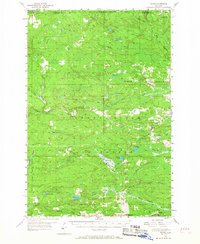
1955 Map of Ralph
USGS Topo · Published 1957About this map
The Escanaba and Lake Superior railroad anchors the local geography of the central Upper Peninsula, serving the small communities of Ralph and Stafford in the mid-1950s. This region is defined by its extensive public lands, spanning the Michigamme State Forest, Sturgeon River State Forest, and Felch Mountain State Forest. The presence of the Ralph Landing Field and White Run Landing Field suggests a landscape managed for fire observation and aerial access, supported by the Escanaba River Lookout Tower to the northeast.
Find a feature on this map
37 named features on this map. Tap any name to fly to it.
Don’t see what you’re looking for? This feature index may not catch every label — zoom into the map to look around manually.
Map Details
Editions of this 1955 Ralph Map
3 editions found
Other maps of this area

1899 · Sagola
USGS Topo · 1:62,500

1899 · Witbeck
USGS Topo · 1:62,500

1939 · Iron Mountain
USGS Topo · 1:48,000

1941 · Iron Mountain
USGS Topo · 1:48,000

1947 · Iron Mountain
USGS Topo · 1:48,000

1952 · Ishpeming
USGS Topo · 1:62,500

1954 · Iron Mountain
USGS Topo · 1:250,000

1954 · Escanaba
USGS Topo · 1:250,000

1955 · Witch Lake
USGS Topo · 1:24,000

1955 · Ralph NW
USGS Topo · 1:24,000