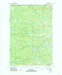
1955 Map of Ralph
USGS Topo · Published 1985About this map
Ralph and the southern edge of the Escanaba River State Forest define this mid-century landscape on the border of Marquette and Dickinson counties. The Escanaba and Lake Superior railroad follows the path of the West Branch Escanaba River, illustrating the vital connection between timber extraction and transportation in Michigan's Upper Peninsula. Settlement is concentrated around the small village of Ralph, where the Ralph Cem and Ralph Landing Field serve as local landmarks. Further south, the terrain transitions into the rugged drainage basins of the North Branch Sturgeon River and East Branch Sturgeon River. For genealogists and historians, the map preserves the location of smaller locales like Theodore near Felch Mountain and numerous named water bodies like O'Neil Lake, Sixmile Lake, and Norway Lake that shaped the region's early logging and sporting life.
Find a feature on this map
37 named features on this map. Tap any name to fly to it.
Don’t see what you’re looking for? This feature index may not catch every label — zoom into the map to look around manually.
Map Details
Editions of this 1955 Ralph Map
3 editions found

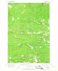
Other maps of this area

1899 · Sagola
USGS Topo · 1:62,500

1899 · Witbeck
USGS Topo · 1:62,500

1939 · Iron Mountain
USGS Topo · 1:48,000

1941 · Iron Mountain
USGS Topo · 1:48,000

1947 · Iron Mountain
USGS Topo · 1:48,000

1952 · Ishpeming
USGS Topo · 1:62,500

1954 · Iron Mountain
USGS Topo · 1:250,000

1954 · Escanaba
USGS Topo · 1:250,000

1955 · Witch Lake
USGS Topo · 1:24,000

1955 · Ralph NW
USGS Topo · 1:24,000