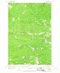
1955 Map of Ralph
USGS Topo · Published 1968About this map
Ralph serves as the primary hub of this northern woodland, situated at the crossing of the Escanaba and Lake Superior Railroad and the Ford River. The settlement's local infrastructure is detailed through the Ralph Cem and the Ralph Landing Field, reflecting its role as a remote pocket of habitation within the Michigan State Forest. The geography is defined by a dense network of water, including the Escanaba River to the east and the Sturgeon River to the south, with the Escanaba River Lookout Tower standing as a sentinel over the timberland.
Find a feature on this map
37 named features on this map. Tap any name to fly to it.
Don’t see what you’re looking for? This feature index may not catch every label — zoom into the map to look around manually.
Map Details
Editions of this 1955 Ralph Map
3 editions found

Other maps of this area

1899 · Sagola
USGS Topo · 1:62,500

1899 · Witbeck
USGS Topo · 1:62,500

1939 · Iron Mountain
USGS Topo · 1:48,000

1941 · Iron Mountain
USGS Topo · 1:48,000

1947 · Iron Mountain
USGS Topo · 1:48,000

1952 · Ishpeming
USGS Topo · 1:62,500

1954 · Iron Mountain
USGS Topo · 1:250,000

1954 · Escanaba
USGS Topo · 1:250,000

1955 · Witch Lake
USGS Topo · 1:24,000

1955 · Ralph NW
USGS Topo · 1:24,000