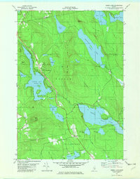
1982 Map of Green Lake
USGS Topo · Published 1982About this map
Green Lake and its surrounding highlands dominate this 1982 survey of the interior landscape where Hancock County meets Penobscot County. The settlement at Lucerne-in-Maine sits nestled between the shores of Phillips Lake and the rising slopes of Chase Mtn, featuring a central Golf Course that signals the area's development as a recreational destination. Further south, the Our Lady of the Lake Chapel stands near the shore of Green Lake, while the cross-roads at Wilson Corner provides a gateway to Branch Lake. The terrain is characterized by massive granite-like outcrops such as Big Hill and Bald Mtn, the latter of which serves as a site for a Radio Tower. The Maine Central railroad corridor tracks along the western edge of these lakes, connecting the remote woods and bogs, like Mann Bog and Coon Bog, to the broader regional economy.
Find a feature on this map
47 named features on this map. Tap any name to fly to it.
Don’t see what you’re looking for? This feature index may not catch every label — zoom into the map to look around manually.
Map Details
Editions of this 1982 Green Lake Map
2 editions found
Other maps of this area

1900 · Orland
USGS Topo · 1:62,500

1902 · Orono
USGS Topo · 1:62,500

1911 · Ellsworth
USGS Topo · 1:62,500

1929 · Great Pond
USGS Topo · 1:48,000

1932 · Great Pond
USGS Topo · 1:62,500

1940 · Ellsworth
USGS Topo · 1:62,500

1942 · Orland
USGS Topo · 1:62,500

1942 · Ellsworth
USGS Topo · 1:62,500

1944 · Orono
USGS Topo · 1:62,500

1946 · Orono
USGS Topo · 1:62,500