
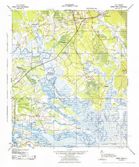
1943 Map of Green Pond
USGS Topo · Published 1943About this map
The Combahee River and its intricate network of tidal channels dominate this Lowcountry landscape during the early 1940s. The border between Beaufort and Colleton counties meanders through the wetlands, where the Seaboard and Atlantic Coast Line railroads intersect the riverine economy. Historic community centers are evidenced by numerous rural sanctuaries, including First African Ch, Mount Sinai Ch, and St Marys Ch.
Find a feature on this map
54 named features on this map. Tap any name to fly to it.
Don’t see what you’re looking for? This feature index may not catch every label — zoom into the map to look around manually.
Map Details
Editions of this 1943 Green Pond Map
2 editions found
Other maps of this area

1918 · Walterboro
USGS Topo · 1:62,500

1918 · Green Pond
USGS Topo · 1:62,500

1918 · Yemassee
USGS Topo · 1:62,500

1918 · Cottageville
USGS Topo · 1:62,500

1919 · Edisto Island
USGS Topo · 1:62,500

1919 · Cummings
USGS Topo · 1:62,500

1920 · Okatie
USGS Topo · 1:62,500

1920 · St. Helena Sound
USGS Topo · 1:62,500

1942 · Okatie
USGS Topo · 1:62,500

1943 · Cottageville
USGS Topo · 1:62,500