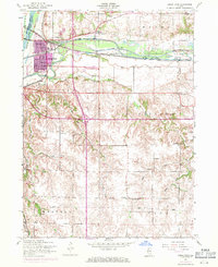
1953 Map of Green Rock
USGS Topo · Published 1971About this map
The Rock River and Green River converge near the growing mid-century community of Green Rock, marking a landscape defined by 19th-century infrastructure and modern expansion. The Illinois-Mississippi Canal (Abandoned) runs parallel to the river, a relic of an earlier transportation era that sits alongside the active tracks of the Chicago Rock Island and Pacific railroad. To the south, the terrain transitions into the creek-carved uplands of Edford and Western townships.
Find a feature on this map
35 named features on this map. Tap any name to fly to it.
Don’t see what you’re looking for? This feature index may not catch every label — zoom into the map to look around manually.
Map Details
Editions of this 1953 Green Rock Map
3 editions found
Other maps of this area

1892 · Leclaire
USGS Topo · 1:62,500

1893 · Leclaire
USGS Topo · 1:62,500

1899 · Clinton
USGS Topo · 1:125,000

1934 · Geneseo
USGS Topo · 1:62,500

1937 · Orion
USGS Topo · 1:62,500

1949 · Coal Valley
USGS Topo · 1:24,000

1949 · Silvis
USGS Topo · 1:24,000

1949 · Port Byron
USGS Topo · 1:24,000

1950 · Port Byron
USGS Topo · 1:24,000

1952 · Erie
USGS Topo · 1:62,500