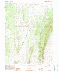
1990 Map of Green Springs NW
USGS Topo · Published 1990About this map
The Pancake Range dominates this corner of White Pine County, forming a high backbone between the broad expanses of Newark Valley to the north and Railroad Valley to the southeast. Compiled from mid-1980s aerial photography, this provisional record identifies the quiet extractive activity typical of the high desert, with multiple Prospects and a singular Prospect scattered throughout the higher elevations. These markings suggest small-scale mineral exploration or historic mining claims that were still of interest during the field checks in the late 1980s. Water management is sparse but critical, evidenced by the drainage of Bull Creek and a localized Stock Pond, reflecting the area's primary use for open-range grazing. The landscape is defined by its topographic isolation, where travel is limited to unimproved roads and trails cutting through the high basins.
Find a feature on this map
7 named features on this map. Tap any name to fly to it.
Don’t see what you’re looking for? This feature index may not catch every label — zoom into the map to look around manually.
Map Details
Editions of this 1990 Green Springs NW Map
This is the sole edition of this map. No revisions or reprints were ever made.
Other maps of this area

1951 · Green Springs
USGS Topo · 1:62,500

1951 · Pancake Summit
USGS Topo · 1:62,500

1953 · Pinto Summit
USGS Topo · 1:62,500

1956 · Ely
USGS Topo · 1:250,000

1959 · Ely
USGS Topo · 1:250,000

1963 · Ely
USGS Topo · 1:250,000

1964 · Moody Peak
USGS Topo · 1:62,500

1979 · Mt. Hamilton
USGS Topo · 1:100,000

1990 · Pancake Summit SW
USGS Topo · 1:24,000
1990 · Seligman Canyon
USGS Topo · 1:24,000