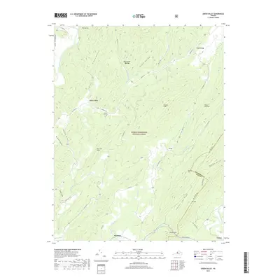
2019 Map of Green Valley
USGS Topo · Published 2019About this map
Green Valley and the surrounding reaches of the George Washington National Forest define this 2019 survey of the Virginia highlands. The landscape is characterized by a series of parallel ridges and deep hollows, including Chestnut Ridge and Black Oak Ridge, which separate the drainage of the Cowpasture River in the west from the Calfpasture River in the east. Small settlements such as Hotchkiss, Armstrong, and Yost are situated along the narrow valley floors, connected by rural routes like Deerfield Rd and State Rte 629.
Find a feature on this map
45 named features on this map. Tap any name to fly to it.
Don’t see what you’re looking for? This feature index may not catch every label — zoom into the map to look around manually.
Map Details
Editions of this 2019 Green Valley Map
This is the sole edition of this map. No revisions or reprints were ever made.
Other maps of this area

1894 · Staunton
USGS Topo · 1:125,000

1894 · Natural Bridge
USGS Topo · 1:125,000

1894 · Lexington
USGS Topo · 1:125,000

1901 · Monterey
USGS Topo · 1:125,000

1932 · Lexington
USGS Topo · 1:48,000

1937 · Lexington
USGS Topo · 1:62,500

1943 · Craigsville
USGS Topo · 1:62,500

1945 · Craigsville
USGS Topo · 1:62,500

1946 · Millboro
USGS Topo · 1:62,500

1946 · Williamsville
USGS Topo · 1:62,500