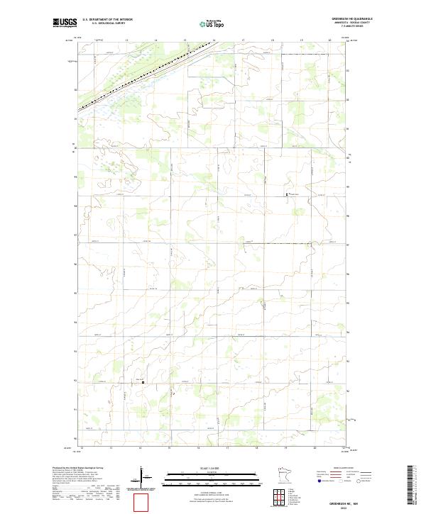
2022 Map of Greenbush NE
USGS Topo · Published 2022About this map
The winding course of S Br Two Rivers cuts across the northern reaches of this Roseau County landscape, providing a natural break in the otherwise rigid grid of the Public Land Survey System. The area is defined by a dense network of section-line roads, including Co Rd 111 and Co Rd 25, which organize the agricultural and wetland terrain into a systematic patchwork. For those exploring local family histories, several key landmarks anchor the rural community. Barnett Cem is situated in the northeastern quadrant, while Zion Cem is located further south near 170th St. These sites, along with the numerous county roads like Co Rd 104 and Co Rd 22, trace the established patterns of rural life and transit in the early twenty-first century.
Find a feature on this map
29 named features on this map. Tap any name to fly to it.
Don’t see what you’re looking for? This feature index may not catch every label — zoom into the map to look around manually.
Map Details
Editions of this 2022 Greenbush NE Map
This is the sole edition of this map. No revisions or reprints were ever made.
Other maps of this area

1918 · Roseau
USGS Topo · 1:62,500

1918 · Garland
USGS Topo · 1:62,500

1918 · Greenbush
USGS Topo · 1:62,500

1919 · Badger
USGS Topo · 1:62,500

1952 · Thief River Falls
USGS Topo · 1:250,000

1954 · Roseau
USGS Topo · 1:250,000

1956 · Thief River Falls
USGS Topo · 1:250,000

1957 · Roseau
USGS Topo · 1:250,000

1957 · Thief River Falls
USGS Topo · 1:250,000

1958 · Roseau
USGS Topo · 1:250,000